


 |
||||||||||||||||||||||||||||||||||||||||||||||||||||||||||||||||||||||||||||||||||||||||||
| Note!! The photos become increasingly impressive towards Day 5;
Scroll all the way down for some great big alpine pictures!! |
||||||||||||||||||||||||||||||||||||||||||||||||||||||||||||||||||||||||||||||||||||||||||
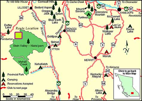
| Area Overview | ||||||||||||||||||||||||||||||||||||||||||||||||||||||||||||||||||||||||||||||||||||||||||
 |
||||||||||||||||||||||||||||||||||||||||||||||||||||||||||||||||||||||||||||||||||||||||||
| Click on Maps to Enlarge | ||||||||||||||||||||||||||||||||||||||||||||||||||||||||||||||||||||||||||||||||||||||||||
| Route Overview - Illustrated Colour | ||||||||||||||||||||||||||||||||||||||||||||||||||||||||||||||||||||||||||||||||||||||||||
 |
||||||||||||||||||||||||||||||||||||||||||||||||||||||||||||||||||||||||||||||||||||||||||
| Route Overview - Topographical | ||||||||||||||||||||||||||||||||||||||||||||||||||||||||||||||||||||||||||||||||||||||||||
 |
||||||||||||||||||||||||||||||||||||||||||||||||||||||||||||||||||||||||||||||||||||||||||
| Day 1 | ||||||||||||||||||||||||||||||||||||||||||||||||||||||||||||||||||||||||||||||||||||||||||
 |
||||||||||||||||||||||||||||||||||||||||||||||||||||||||||||||||||||||||||||||||||||||||||
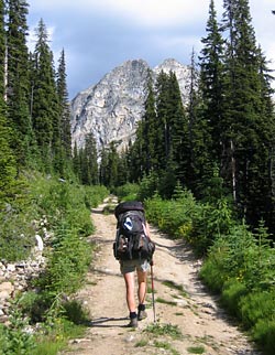
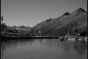
| Left North Van. at 7:30 and high-tailed it on the Sea-toSky to the Blowdown road at Duffey Lake. Drove up BR6 off the Blowdown Main and parked about halfway along this road in a clearing. Began hiking the gradually inclining road at 12:00 and made it to Blowdown Lake an hour later.
Dripping sweat, the lake below us looked just too tempting to pass up. The water was icy, but not enough to prevent a quick dunking! |
||||||||||||||||||||||||||||||||||||||||||||||||||||||||||||||||||||||||||||||||||||||||||
 |
||||||||||||||||||||||||||||||||||||||||||||||||||||||||||||||||||||||||||||||||||||||||||
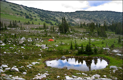
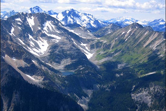
| Blowdown Lake and Blowdown Pass (at far right) below the slopes of Gott Peak | ||||||||||||||||||||||||||||||||||||||||||||||||||||||||||||||||||||||||||||||||||||||||||
 |
||||||||||||||||||||||||||||||||||||||||||||||||||||||||||||||||||||||||||||||||||||||||||
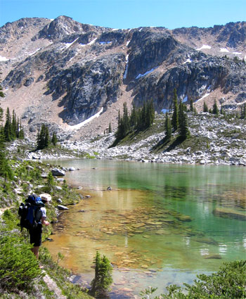
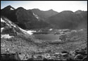
| Sufficiently cooled off, we slung on our packs and made our way to Kidney Lakes.
A well defined trail leaves Blowdown Lake and leads to a short, but very steep, climb up to the plateau where the lakes lie. The trail pretty much dissipates at the foot of this climb and its up to you to pick your way along the terrain to the lakes. |
||||||||||||||||||||||||||||||||||||||||||||||||||||||||||||||||||||||||||||||||||||||||||
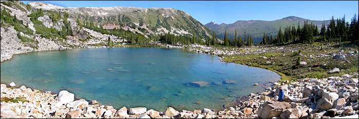
| Arriving at Kidney Lakes | ||||||||||||||||||||||||||||||||||||||||||||||||||||||||||||||||||||||||||||||||||||||||||
 |
||||||||||||||||||||||||||||||||||||||||||||||||||||||||||||||||||||||||||||||||||||||||||
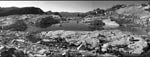
| Kidney Lakes with the slopes of Gott Peak at right | ||||||||||||||||||||||||||||||||||||||||||||||||||||||||||||||||||||||||||||||||||||||||||
 |
||||||||||||||||||||||||||||||||||||||||||||||||||||||||||||||||||||||||||||||||||||||||||
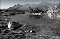
| We settled into lunch on the shore of the upper lake at about 2:15. About 45 min. later we were pushing off again, having consulted the topo map and having set an objective to make camp at one of the small tarns just befor Cirque Lake.
We didn't descend from the lakes outflow as recommended in the guide book, but rather maintained our elevation and then gained some. |
||||||||||||||||||||||||||||||||||||||||||||||||||||||||||||||||||||||||||||||||||||||||||
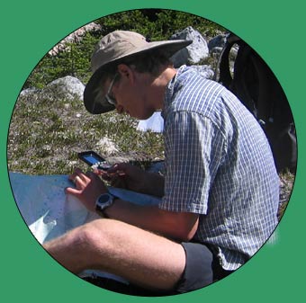
| Andre with compass consulting map | ||||||||||||||||||||||||||||||||||||||||||||||||||||||||||||||||||||||||||||||||||||||||||
 |
||||||||||||||||||||||||||||||||||||||||||||||||||||||||||||||||||||||||||||||||||||||||||
| Slow going in the mid-afternoon heat with loaded packs over the boulder fields | ||||||||||||||||||||||||||||||||||||||||||||||||||||||||||||||||||||||||||||||||||||||||||
| The going got slower and harder as we had to make our way over a rather large boulder field. The slopes eventually became extremely steep to sidehill along, so we climbed up through a narrow chute to a small plateau. A wet meadow lay below us on the opposite side and we were rewarded with a view of a jewel of a lake about 1 km away. Andre was convinced it was Cirque Lake; I was not.
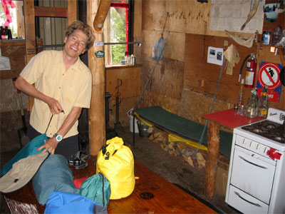
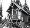
Climbed down into the meadows, then through the easier forested terrain to the lake. We stumbled upon a major trail leading from the creek valley below to the lake, and discovered it led right to a small backcountry cabin!! My jaw dropped straight to the ground at this unexpected sight!!! |
||||||||||||||||||||||||||||||||||||||||||||||||||||||||||||||||||||||||||||||||||||||||||
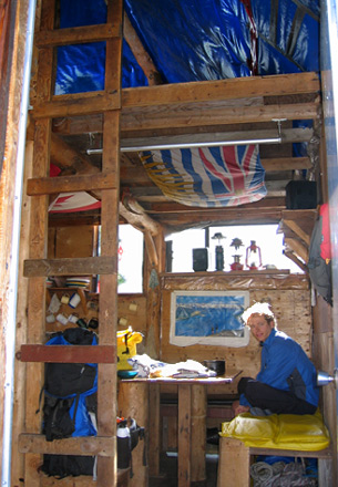
| Inside the cabin we found a propane stove, wood stove, dishes galore, a functional stereo, counter, sink & table, benches, beds (2 plus ample room in the loft), lots of clean bedding and lots of photos and maps on the walls.
It was hot in the cabin, so we set up our tent in the flat, grassy meadow next to the lake. We washed up, put warm clothes on and crashed in the tent - only to wake up an hour later to find the temperature had plummeted after sunset and about a million mosquitoes on our tent ! Hmmmm... doesn't take a genius to make a leap for the cabin at this point! We left the tent set up, but took everything else into the cabin where we cooked, ate and slept in warm, bug-free comfort! |
 |
|||||||||||||||||||||||||||||||||||||||||||||||||||||||||||||||||||||||||||||||||||||||||
| Day 2 | ||||||||||||||||||||||||||||||||||||||||||||||||||||||||||||||||||||||||||||||||||||||||||
| The resident rodent made its first appearance at 1:30 in the morning, scuttling around the loft and clattering around in the dishes in the kitchen below. Didn't get much sleep in and got up at 6:45 to find perfectly clear blue skies all around. | ||||||||||||||||||||||||||||||||||||||||||||||||||||||||||||||||||||||||||||||||||||||||||
 |
 |
|||||||||||||||||||||||||||||||||||||||||||||||||||||||||||||||||||||||||||||||||||||||||
| Breakfast in the cabin | ||||||||||||||||||||||||||||||||||||||||||||||||||||||||||||||||||||||||||||||||||||||||||
| The peaked shadow of the cabin with our tent and the lake below the sub-peak to "Gottless Mtn" | ||||||||||||||||||||||||||||||||||||||||||||||||||||||||||||||||||||||||||||||||||||||||||
 |
||||||||||||||||||||||||||||||||||||||||||||||||||||||||||||||||||||||||||||||||||||||||||
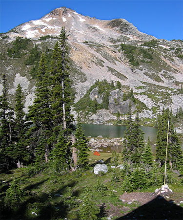
| Full view of the lake; Blowdown Creek valley and Gott Peak ridge just right of center, the meadows where our tent is at right of lake and the cabin (out of view) to the right edge of the photo. | ||||||||||||||||||||||||||||||||||||||||||||||||||||||||||||||||||||||||||||||||||||||||||
| We first hiked up to the pass and gained a spectacular view of Cirque Lake, then hiked up to the sub-peak below "Gottless Mtn." Spectacular views, even over to where we'd hiked a couple weeks before up Siwhe Creek and the Stein Divide. Hiked back down to the pass, then continued down to Cirque Lake. Sweltering hot, we had lunch and cooled off with an ultra-quick splash in the lake. More scenery beconned, so we made our way back to the cabin, rested for a few minutes then departed on an early evening trek up the mountainside behind the cabin to the tarns below Red Rocks and the col with great views down Cottonwood Creek. On the way down, we enjoyed a loooong refreshing swim in a small tarn right on the edge of the plateau. Shallow and surrounded by rock it had soaked up all the days heat, making for the ultimate in swimming pools! | ||||||||||||||||||||||||||||||||||||||||||||||||||||||||||||||||||||||||||||||||||||||||||
 |
 |
 |
 |
 |
 |
|||||||||||||||||||||||||||||||||||||||||||||||||||||||||||||||||||||||||||||||||||||
 |
 |
|||||||||||||||||||||||||||||||||||||||||||||||||||||||||||||||||||||||||||||||||||||||||
 |
||||||||||||||||||||||||||||||||||||||||||||||||||||||||||||||||||||||||||||||||||||||||||
 |
||||||||||||||||||||||||||||||||||||||||||||||||||||||||||||||||||||||||||||||||||||||||||
 |
||||||||||||||||||||||||||||||||||||||||||||||||||||||||||||||||||||||||||||||||||||||||||
 |
||||||||||||||||||||||||||||||||||||||||||||||||||||||||||||||||||||||||||||||||||||||||||
| Day 3 | ||||||||||||||||||||||||||||||||||||||||||||||||||||||||||||||||||||||||||||||||||||||||||
 |
||||||||||||||||||||||||||||||||||||||||||||||||||||||||||||||||||||||||||||||||||||||||||
| Woke up at 8:30 after a looong, deep sleep - I guess the previous days 3-hikes-in-one demanded some serious recovery time! Overcast skies this morning, but nothing threatening as we packed up and took the tent down that we'd left in the meadows. | ||||||||||||||||||||||||||||||||||||||||||||||||||||||||||||||||||||||||||||||||||||||||||
 |
 |
|||||||||||||||||||||||||||||||||||||||||||||||||||||||||||||||||||||||||||||||||||||||||
 |
||||||||||||||||||||||||||||||||||||||||||||||||||||||||||||||||||||||||||||||||||||||||||
 |
||||||||||||||||||||||||||||||||||||||||||||||||||||||||||||||||||||||||||||||||||||||||||
|
We decided against the higher, boulder & chute route we'd taken on the way in, considering there was a perfectly good trail leading out. We assumed it led to Blowdown Lake..... Never, ever assume anything! Two hours later we found ourselves descending the valley below where we'd parked the van!! If you ever want to see two hopping mad hikers... We'd lost considerable elevation and found ourselves coming out on BR5, one branch line below the van. We trudged along the road, then up BR6 only to find ourselves back at the van at noon - hungry, hot and irritated. When we'd set out 2 days before we didn't exactly want to see halfway through the trip. Well, it made a good bug shelter for lunch, and while we were there we off-loaded the water filter and some extra food. |
||||||||||||||||||||||||||||||||||||||||||||||||||||||||||||||||||||||||||||||||||||||||||
 |
||||||||||||||||||||||||||||||||||||||||||||||||||||||||||||||||||||||||||||||||||||||||||
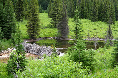
| One of the 2 large beaver dams in the Blowdown Creek valley. We were joking that the beavers could sell some of the power to BC Hydro, their dams were so sizeable! | ||||||||||||||||||||||||||||||||||||||||||||||||||||||||||||||||||||||||||||||||||||||||||
 |
||||||||||||||||||||||||||||||||||||||||||||||||||||||||||||||||||||||||||||||||||||||||||
|
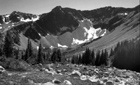
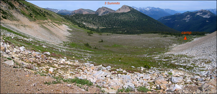
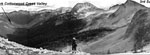
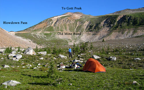
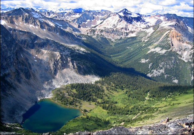
View east into the Cottonwood Creek Valley from Blowdown Pass. We hiked 3 Summits on Day 4.
|
||||||||||||||||||||||||||||||||||||||||||||||||||||||||||||||||||||||||||||||||||||||||||
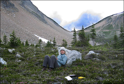
| From the van, we retraced our footsteps from 2 days before to Blowdown Lake. Even though it was cool and overcast, a quick dip in the icy water made for a refreshing wash. Within 20 minutes of leaving the lake we were up in Blowdown Pass, which proved very true to its name - the wind was just ripping through the narrow pass.
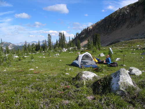
We found ourselves looking into a vast plain of meadows, through which an old mine road cut down into the Cottonwood Valley on its way to the Silver Queen Mine. We descended into the meadows and camped near some tiny ponds, sheltered from the wind. |
||||||||||||||||||||||||||||||||||||||||||||||||||||||||||||||||||||||||||||||||||||||||||
 |
||||||||||||||||||||||||||||||||||||||||||||||||||||||||||||||||||||||||||||||||||||||||||
|
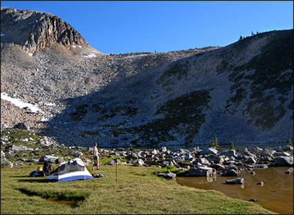
Our alpine camp. Below: Blowdown Pass and the mine road are visible at right.
|
||||||||||||||||||||||||||||||||||||||||||||||||||||||||||||||||||||||||||||||||||||||||||
 |
||||||||||||||||||||||||||||||||||||||||||||||||||||||||||||||||||||||||||||||||||||||||||
| Day 4 | ||||||||||||||||||||||||||||||||||||||||||||||||||||||||||||||||||||||||||||||||||||||||||
 |
||||||||||||||||||||||||||||||||||||||||||||||||||||||||||||||||||||||||||||||||||||||||||
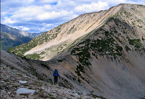
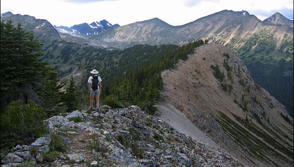
| The long ridge over 3 Summits beckonned, so we made our way through the marmot-crazy meadows to the low point on the ridge (photo at right) and enjoyed the spectacular hike along the long ridge right to the 3rd peak. | ||||||||||||||||||||||||||||||||||||||||||||||||||||||||||||||||||||||||||||||||||||||||||
 |
||||||||||||||||||||||||||||||||||||||||||||||||||||||||||||||||||||||||||||||||||||||||||
|
View to the 3rd Summit and the ridge approach.
|
||||||||||||||||||||||||||||||||||||||||||||||||||||||||||||||||||||||||||||||||||||||||||
 |
||||||||||||||||||||||||||||||||||||||||||||||||||||||||||||||||||||||||||||||||||||||||||
 |
||||||||||||||||||||||||||||||||||||||||||||||||||||||||||||||||||||||||||||||||||||||||||
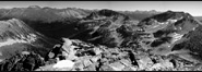
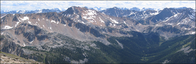
| 2 Panoramas from the ridge | ||||||||||||||||||||||||||||||||||||||||||||||||||||||||||||||||||||||||||||||||||||||||||
 |
||||||||||||||||||||||||||||||||||||||||||||||||||||||||||||||||||||||||||||||||||||||||||
 |
||||||||||||||||||||||||||||||||||||||||||||||||||||||||||||||||||||||||||||||||||||||||||
 |
||||||||||||||||||||||||||||||||||||||||||||||||||||||||||||||||||||||||||||||||||||||||||
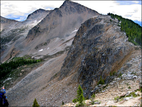
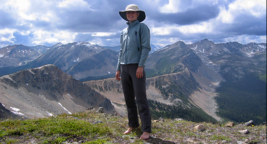
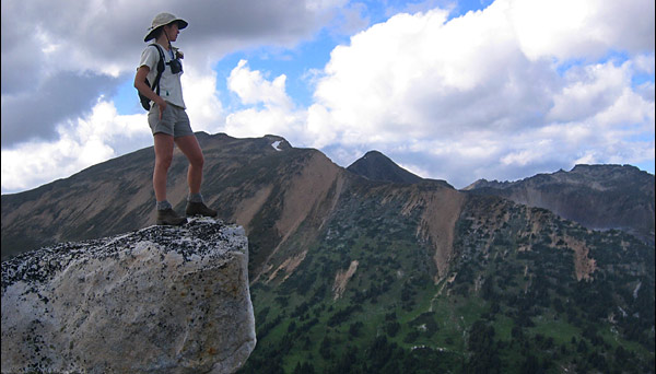
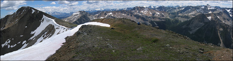
| The long ridge we'd hiked from our camp in the pass is visible behind me. Blowdown Pass and our camp is actually directly behind me. | ||||||||||||||||||||||||||||||||||||||||||||||||||||||||||||||||||||||||||||||||||||||||||
 |
||||||||||||||||||||||||||||||||||||||||||||||||||||||||||||||||||||||||||||||||||||||||||
 |
||||||||||||||||||||||||||||||||||||||||||||||||||||||||||||||||||||||||||||||||||||||||||
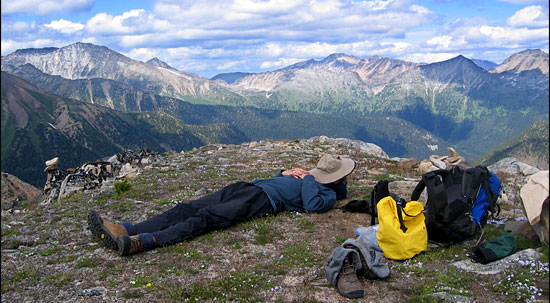
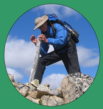
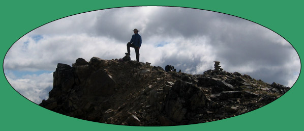
| After a good long rest and lunch (above), Andre set about carving a date into the blank metal plate on the peak marker. | ||||||||||||||||||||||||||||||||||||||||||||||||||||||||||||||||||||||||||||||||||||||||||
 |
||||||||||||||||||||||||||||||||||||||||||||||||||||||||||||||||||||||||||||||||||||||||||
 |
||||||||||||||||||||||||||||||||||||||||||||||||||||||||||||||||||||||||||||||||||||||||||
 |
||||||||||||||||||||||||||||||||||||||||||||||||||||||||||||||||||||||||||||||||||||||||||
 |
||||||||||||||||||||||||||||||||||||||||||||||||||||||||||||||||||||||||||||||||||||||||||
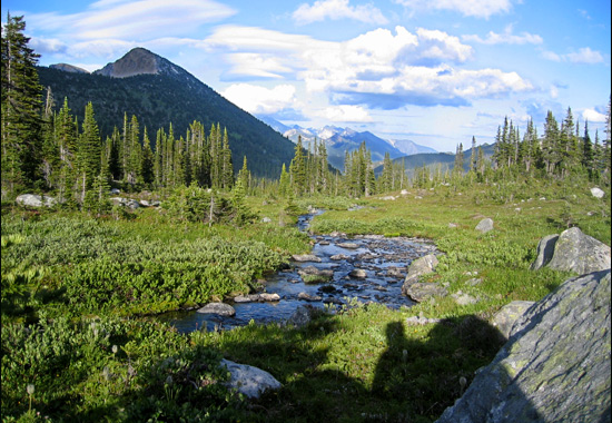
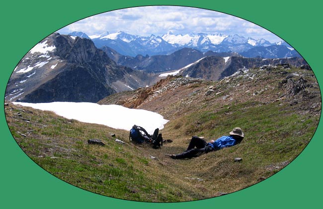
| Back at camp enjoying some evening sun | ||||||||||||||||||||||||||||||||||||||||||||||||||||||||||||||||||||||||||||||||||||||||||
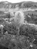
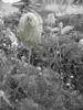
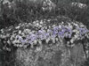
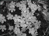
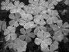
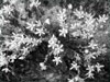
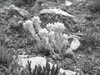
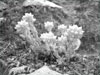
| Some Great Alpine Flower Shots... | ||||||||||||||||||||||||||||||||||||||||||||||||||||||||||||||||||||||||||||||||||||||||||
 |
 |
 |
||||||||||||||||||||||||||||||||||||||||||||||||||||||||||||||||||||||||||||||||||||||||
 |
||||||||||||||||||||||||||||||||||||||||||||||||||||||||||||||||||||||||||||||||||||||||||
 |
 |
|||||||||||||||||||||||||||||||||||||||||||||||||||||||||||||||||||||||||||||||||||||||||
 |
||||||||||||||||||||||||||||||||||||||||||||||||||||||||||||||||||||||||||||||||||||||||||
 |
 |
|||||||||||||||||||||||||||||||||||||||||||||||||||||||||||||||||||||||||||||||||||||||||
| Day 5 | ||||||||||||||||||||||||||||||||||||||||||||||||||||||||||||||||||||||||||||||||||||||||||
 |
||||||||||||||||||||||||||||||||||||||||||||||||||||||||||||||||||||||||||||||||||||||||||
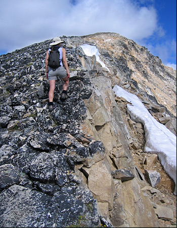
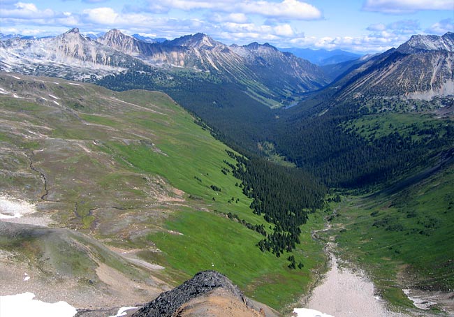
| A sunny, clear and cold morning - a great day to hike up Gott Peak and explore the long ridgeline.
Stunning views awaited us... |
||||||||||||||||||||||||||||||||||||||||||||||||||||||||||||||||||||||||||||||||||||||||||
 |
||||||||||||||||||||||||||||||||||||||||||||||||||||||||||||||||||||||||||||||||||||||||||
| Ascending Gott Peak's rocky ridge | ||||||||||||||||||||||||||||||||||||||||||||||||||||||||||||||||||||||||||||||||||||||||||
 |
||||||||||||||||||||||||||||||||||||||||||||||||||||||||||||||||||||||||||||||||||||||||||
| Blowdown Lake and the mine road cutting across the slope at right | ||||||||||||||||||||||||||||||||||||||||||||||||||||||||||||||||||||||||||||||||||||||||||
 |
||||||||||||||||||||||||||||||||||||||||||||||||||||||||||||||||||||||||||||||||||||||||||
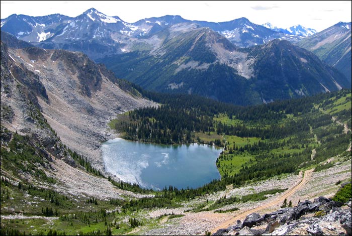
| Wiew north into Gott Creek Valley and Gott Lake (right of center near top) | ||||||||||||||||||||||||||||||||||||||||||||||||||||||||||||||||||||||||||||||||||||||||||
 |
||||||||||||||||||||||||||||||||||||||||||||||||||||||||||||||||||||||||||||||||||||||||||
|
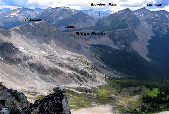
Hover the mouse over the photo below to display route
|
||||||||||||||||||||||||||||||||||||||||||||||||||||||||||||||||||||||||||||||||||||||||||
 |
||||||||||||||||||||||||||||||||||||||||||||||||||||||||||||||||||||||||||||||||||||||||||
 |
||||||||||||||||||||||||||||||||||||||||||||||||||||||||||||||||||||||||||||||||||||||||||
 |
||||||||||||||||||||||||||||||||||||||||||||||||||||||||||||||||||||||||||||||||||||||||||
| Cowboy at rest and play... | ||||||||||||||||||||||||||||||||||||||||||||||||||||||||||||||||||||||||||||||||||||||||||
 |
||||||||||||||||||||||||||||||||||||||||||||||||||||||||||||||||||||||||||||||||||||||||||
| Hover the mouse over the photo below to display routes and lakes
Click on the place names to link to photos |
||||||||||||||||||||||||||||||||||||||||||||||||||||||||||||||||||||||||||||||||||||||||||
 |
||||||||||||||||||||||||||||||||||||||||||||||||||||||||||||||||||||||||||||||||||||||||||
 |
||||||||||||||||||||||||||||||||||||||||||||||||||||||||||||||||||||||||||||||||||||||||||