|
 |
|
|
|
|
 |
|
|
|
 |
|
| GPS waypoints are in UTM NAD83 |
|
 |
|
|
 |
 |
 |
 |
 |
 |
 |
|
|
|
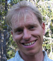
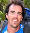
Nick (Texas) |
|
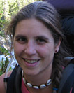
Ashley (Kelowna) |
|
|
|
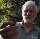
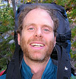
Andre (North Van) |
|
|
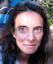
Stephanie (Texas) |
|
|
|
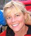
Sarah (Kelowna) |
|
|
|
"No more chit-chat!" |
|
|
|
Trudel (North Van) |
|
|
Reimar (North Van) |
|
|
|
"Has anyone seen the gonfleur?" |
|
|
| "Here, lemme hook you up" |
|
|
| "No really, I'm great! This is so much fun" |
|
|
|
"Vould you like some choclit?" |
|
|
|
"Must... have... TEA!" |
|
|
|
"Let me check the GPS" |
|
|
|
|
 |
|
|
|
 |
|
|
| Topo Map: 92J14
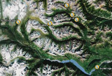
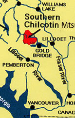
This gives a very general overview: Pretty much directly north of Vancouver by approx. 400 kms.
Nearest Town: Goldbridge, pop.42
For more info., a basic Google search will turn up plenty of info.
|
|
|
 |
|
|
All Maps
All GPS waypoints
|
|
|
|
|
Jump To:
|
|
|
Click on images to view in full size |
|
|
|
 |
|
|
|
|
|
|
 |
|
|
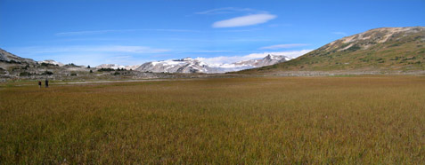
| The South Chilcotin area is unparalleled hiking country - a dream for both novice & advanced backpackers. So, for a third year this became the location for our nearly-annual group hike.
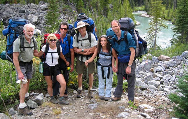
On August 22 the group met up in the grand town of Goldbridge - population 42. What a rockin' scene that place is!
Ashley & Sarah drove in from Kelowna. Nick & Stephanie from Pemberton and Andre, Trudel & Reimar from North Van.
We tore ourselves away from the intense party scene in Goldbridge and headed up to the Jewel Creek trailhead where we set up camp for the first night.
|
|
|
|
|
|
 |
|
|
|
GPS waypoints: |
Trailhead: 490910E, 5639820N |
|
Cable Crossing: 487932E, 5640282N |
Camp: 486415E, 5640784N |
|
|
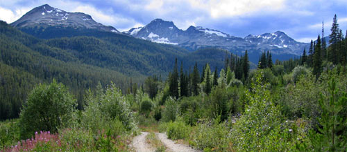
| Mixed skies greeted us this morning and various vehicular technical difficulties prevented us from leaving the Jewel Creek base until early afternoon. On the positive side, by the time we did get mobilized the rain had passed and the sun was out in full Chilcotin force.
It's about 22 km's from Jewel Creek to the Slim trailhead on a very easily driveable road. We were in a VW Jetta and a VW Syncro Van and the Jetta had no difficulties. We won't talk about the van, okay? Good.
|
|
 |
|
|
|
Hiking the last 2 km's up the Slim FSR to the trailhead - the mountains are waiting! |
|
| After various continued vehicular difficulties we managed to get within a good solid 2 km's of the trailhead. Not bad considering the road is actually completely driveable right to the trailhead... |
|
|
|
 |
|
|
|
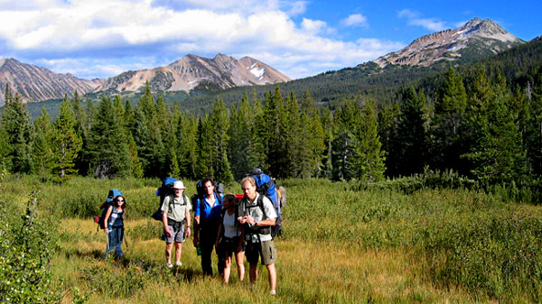
L-R: Reimar, Stephanie, Nick, Andre, Sarah, Ashley; Slim Creek
|
|
|
|
 |
|
|
|
L-R: Sarah, Reimar, Nick, Stephanie, Andre; Leckie Range
|
|
|
|
 |
|
|
| Excitement at the Cable Bridge!
Not really, actually, especially considering we didn't have to cross it. But it made for a good little break and photo opportunity. It's actually quite a spectacular spot.
|
|
| We hiked until somewhere between 6 and 7 that first evening and had a small bit of a tricky time finding a nice camping site. The area we were hiking through was a little bushy with a slight lack of running water. The usual scouts, Andre & Nick, were sent out to "search for clues", well, more like a camp spot. Eventually they returned from separate corners and we followed Andre through bushes and along the creek to a perfect little riverside camping area with plenty of room for us to spread out. |
|
|
|
 |
|
|
|
|
|
 |
|
|
|
Leckie Creek Crossing: 483533E, 5643691N |
|
Lunch: 483329E, 5643734N |
|
Base Camp: 477492E, 5645118N |
|
|
|
Beach: 486054E, 5641540N |
|
|
|
GPS waypoints: |
|
|
 |
|
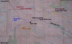
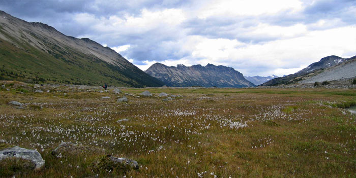
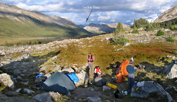
| Quite a long hike awaited us on Day 2 with our objective being to set up base camp in the top of the pass where we'd have easy access to the Griswold & Nichols areas.
Lots of photos to look at, so "no more chit-chat"!
|
|
|
 |
|
|
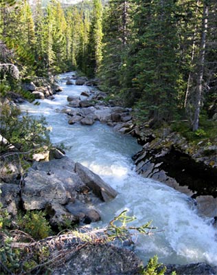
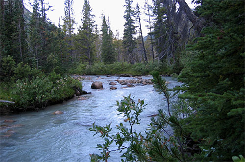
| Above: Slim Creek from our camp
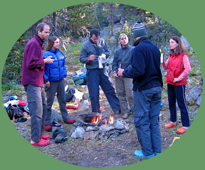
Left: Breakfast around a morning fire (L-R: Ashley, Trudel, Nick, Stephaine, Reimar, Sarah-with-tea)
Red footwear seems to be the thing here...
|
|
|
|
 |
|
|
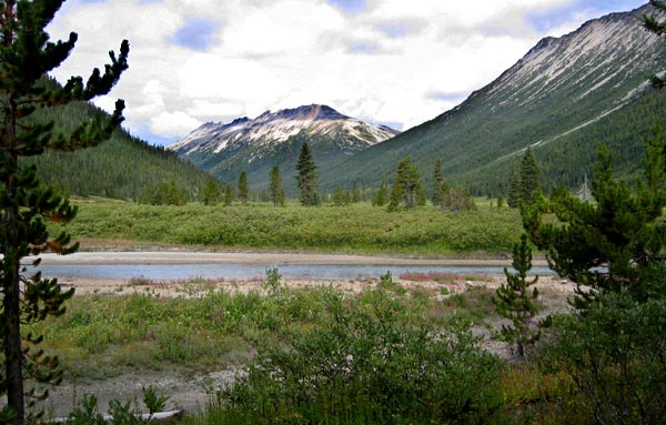
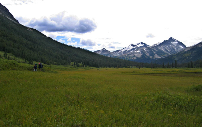
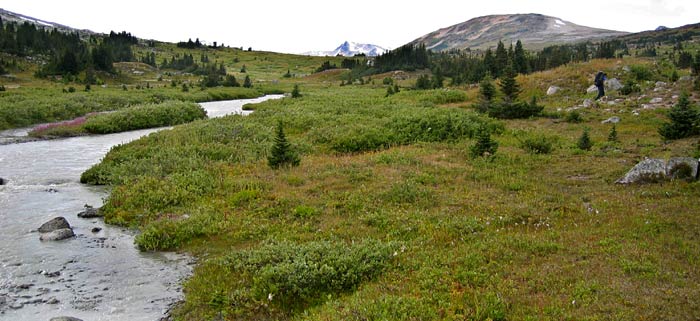
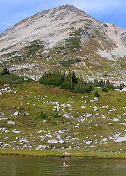
| The trail heads out of the forest and onto this beach at 486054E, 5641540N. That pass between the 2 mountians at right leads up to Leckie Lakes; last year's hike took us up on those peaks and ridges you can see here. |
|
|
 |
|
|
|
Contemplating a swim; tough decision! (L-R: Andre, Sarah, Reimar, Nick, Stephanie, Ashley) |
|
|
|
 |
|
|
|
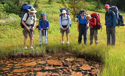
The transition country between timberline and alpine. Very swampy, but staying up higher on dry ground was no problem. That's Sarah and Ashley, btw. |
|
 |
|
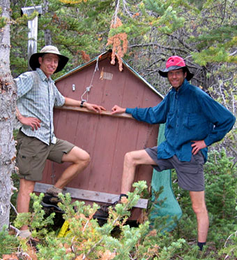
The Grand Slim Valley Resort!
Yep, she's a mansion all right.
Snowmobile warmup hut we assumed...
For you GPS'ers: 484667E, 5643023N
|
|
|
|
 |
|
|
After a bit of trailfinding around the Leckie Creek Crossing, we were getting pretty ready for some lunch. This spot seemed to do it for us nicely.
483329E, 5643734N
|
|
|
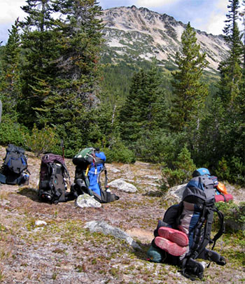
Packs get a break! |
|
|
 |
|
|
|
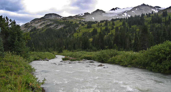
The Upper Slim: Spectacular, Accesible, Remote, Pristine |
|
|
|
 |
|
|
 |
|
|
 |
|
|
|
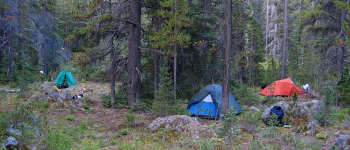
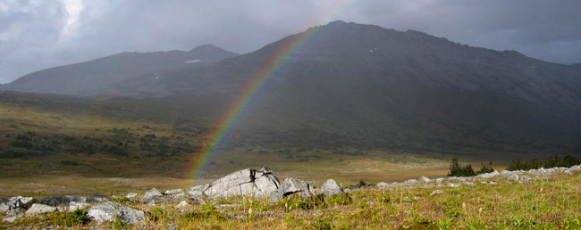
Between 5 and 6 we gained the pass - now it was time to find our base camp for the next 4 nights.
The scouts set out once again, then up the hill a bit we went to our new home.
Just in time too - no sooner were the tents up than a quick and fierce storm pounded through. Luckily it moved on as quickly as it had come in, leaving us with a friendly rainbow greeting.
|
|
|
|
Nick and Stephane share a moment, or is that an All Bran bar?? |
|
|
|
 |
|
|
|
 |
|
|
 |
|
|
|
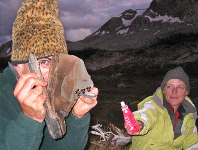
How'd you like to start off a week-long hike with those boots? Well, Stephanie did! They weren't quite that bad when she started, but close! Lucky someone packed a tube of ShoeGoo and was able to do perform some backcountry-shoe-wizardry!
Way to go HiTec - top notch quality
|
|
|
|
|
|
|
|
|
|
|
|
|
|
|
|
|
|
|
|
|
|
|
|
|
|
|
|
|
|
|
|
|
|
|
|
|
|
|
|
|
|
|
|
|
|
|
|
|
|
|
|
|
|
|
|
|
|
|
|
|
|
|
|
|
|
|
|
|
|
|
|
|
|
|
|
|
|
|
|
|
|
|
|
|
|
|
|
|
|
|
|
|
|
|
|
|
|
|
 |
|
|
|
GPS waypoints: |
|
Lunch in Griswold Pass: 472434E, 5649449N |
|
|
|
 |
|
|
|
Our first full day to explore the alpine to our hearts content! We were all anxious to explore, but Andre, Nick and I were especially ready for an early start to a good long, fast paced hike, so we three kings, I mean clowns, headed off first. This day chronicles our adventure, as there was only one camera hound along. Guess who...? |
|
|
|
The Explorers Three |
|
|
|
 |
|
|
|
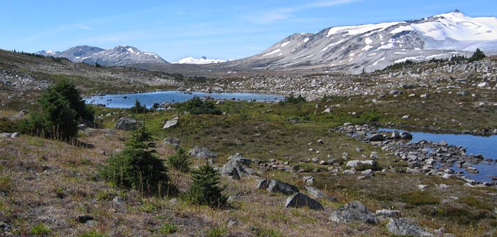
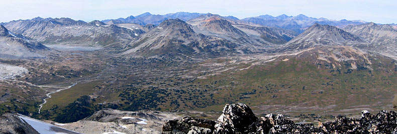
The wide open plains dotted with tarns, surrounded by glaciers |
|
|
|
 |
|
|
|
 |
|
|
 |
|
|
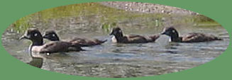
| Above: Lunch! Okay, so we didn't have the heart. Aren't they cute? I spotted these on one of the tarns near the pass. Any idea what they are?
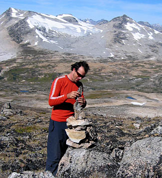
Left: Descending from the ridge across from our base camp Nick once again finds himself unable to resist the urge to make his mark
|
|
|
|
 |
|
|
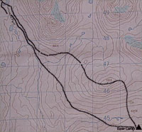
| Topo Detail - click on image |
|
|
|
 |
|
|
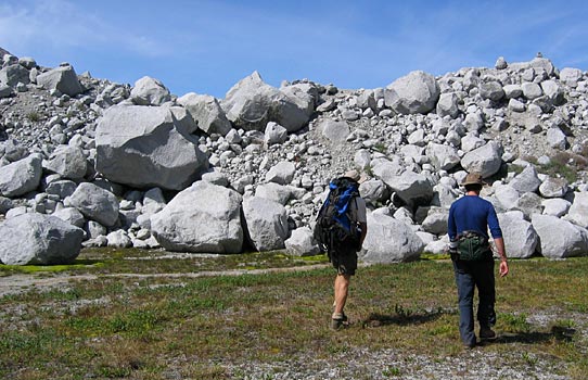
| "Heidi's Wall"
That's what Nick called it. At the moment I can't quite recall why, but I'm sure there was a really good reason. This is not an illusion, these boulders are exactly as large as they look!
Quite the obvious remains of glaciation. We climbed up this "wall" and immidiately found ourselves on the "shore" of a very large but shallow lake.
|
|
|
|
 |
|
|
|
"Heidi's Wall" is at right - you can see the width of the lake we were faced with once we'd climbed it. It seemed like too much effort to walk around it, so heck, we decided to cross it instead. |
|
|
 |
|
|
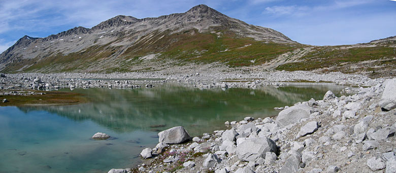
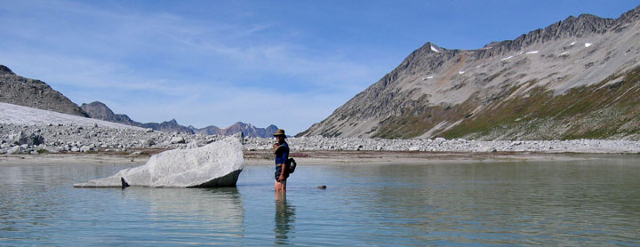
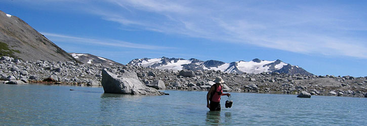
| Crossing one of Griswold's Lakes
The floor of this lake was as slippery as teflon, and only a few places were shallow enough to cross without getting clothing wet. Even the slightest slope would feel like a greased downhill runway, and the water kept clouding over as we'd walk, making avoiding rocks (ouch!) and slopes tricky to avoid. Never mind being bombarded by horseflies!
|
|
|
|
 |
|
|
|
 |
|
|
|
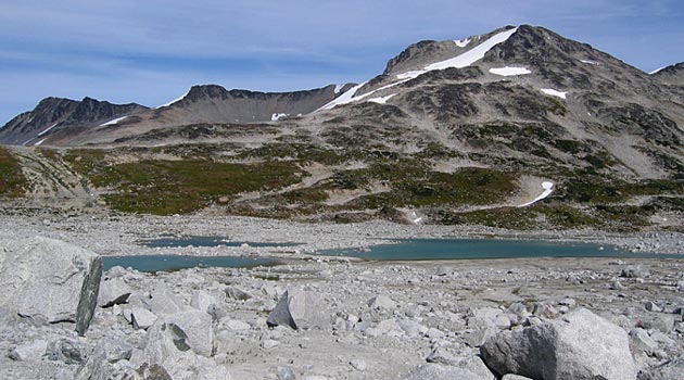
Griswold Pass |
|
|
|
 |
|
|
| After the lake-crossing adventure and having hiked at a pretty fast pace for about 5 hours we were ready for a rest and some food. A large flat sandy area (no doubt the base of a dry lake) suited us well and we settled in for an hour-long break.
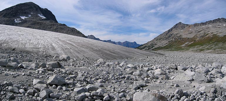
Into a Lair:
The corner of the pass still bekoned us, so after our lunch break we made our way down alongside the foot of the glacier (above). Near the base of it, but well before rounding the corner we stumbled into a small, flat area between some of the enormous boulders only to notice three HUGE piles of Grizzly poop.
|
|
|
 |
Having seen more than enough of these (photo left) around, we figured maybe we'd seen enough of Griswold Pass after all. We didn't really feel like meeting the pass' namesake, and considering the amount of prints around, our chances seemed to lean in that direction.
Also, it was 4:00 at this point. We'd left at about 9:30 that morning and we'd told the others we'd be back around 6:30. Oops - we had some tracks of our own to make!
|
|
|
|
 |
|
|
|
Trudel says, but there's always time for a swim!! |
|
| We travelled a pretty serious pace, cutting corners and using the GPS to carve the straightest line with the minimum elevation gain / loss. Within 3 hours (including the swim) we were back by 7:00 sharp - just before the others hit the worry button. A most excellent day it was! |
|
|
|
**Hover Mouse Over Photo to Display Route Markings**
|
|
|
|
 |
|
|
|
A quick overview of the day. It doesn't quite show base camp, which is just to the right of the photo, and doesn't quite show the descent from the first ridge as we descended the back side. But you get the idea... |
|
|
|
Don't go away! The great scenery is only beginning! Click next to go to the next page.... |
|
next |
|
|
back to top |
|
|
|
|
|
|
|
|
|
|
|
|
|
|
|
|
|
|
|
|
|
|
|
|
|
|
|
|
|
|
|
|
|
|
|
|
|
|
|
|
|
|
|