| continued from page 1 | back | ||||||||||||||||||||||||||||||||||||||||||||||||||
| "Lunch Lake": 473314E, 5643183N | "Texas Lake": 474439E, 5646062N | "Nichol's Lake": 471548E, 5641329N | ||||||||||||||||||||||||||||||||||||||||||||||||
| GPS waypoints: | ||||||||||||||||||||||||||||||||||||||||||||||||||
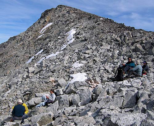
| How about we start Day 4 with a little photo shoot of camp life? Seeing as how we had such a nice spot and spent 4 evenings and mornings there, here's a little overview of our camp situation...
If you want you can click here to skip camp and get on with the day |
||||||||||||||||||||||||||||||||||||||||||||||||||
 |
||||||||||||||||||||||||||||||||||||||||||||||||||
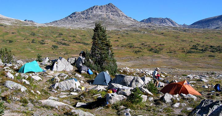
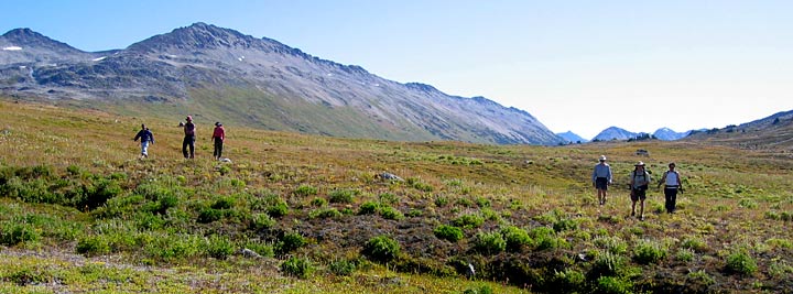
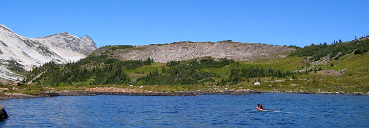
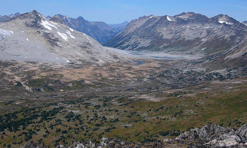
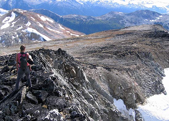
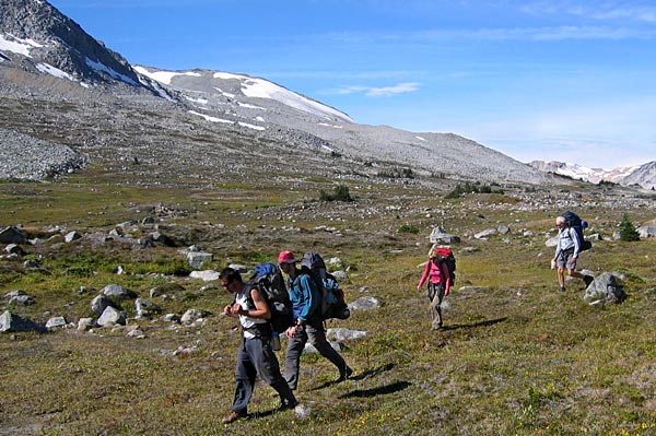
| Above: This views north shows the vast plains of the upper Slim Pass area. Ashley nailed that peak at center on Day 3, and on the group hike in 2005 Andre, myself, Sarah, Ashley & Nick were traversing the rocky slope at the far, far right of this photo.
Back to camp - - - here we have Reimar's tent at far left, with Reimar hunkering just to the left of that tree. Then there's Nick & Stephanie's tent at center. Andre is over there to the right heading for our stylin' "paprika" coloured tent. Nice place to be, all in all! |
||||||||||||||||||||||||||||||||||||||||||||||||||
 |
||||||||||||||||||||||||||||||||||||||||||||||||||
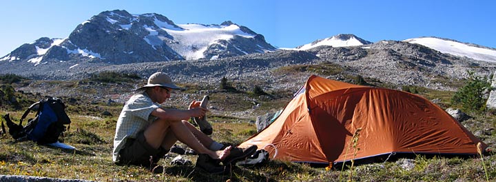
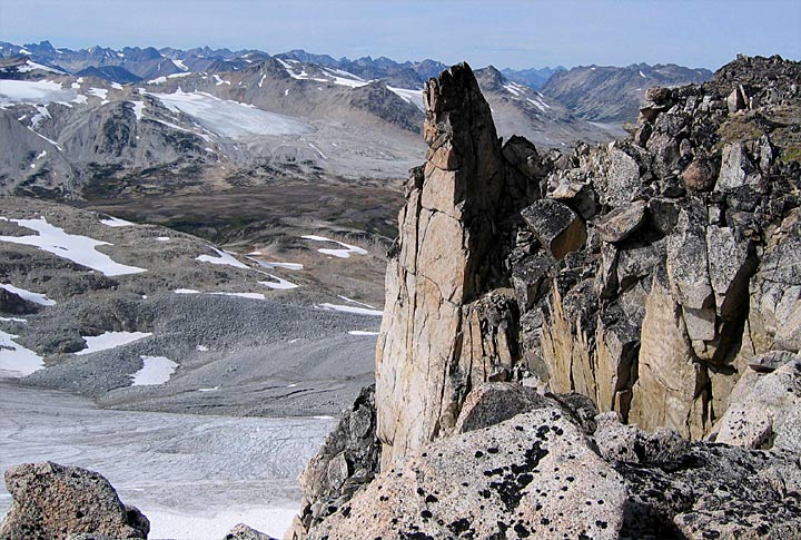
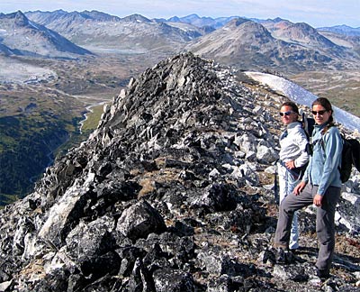
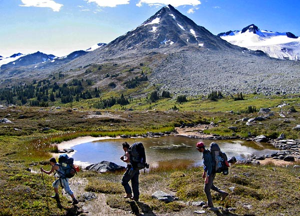
| Above: Okay, so here's me next to our tent (fly's off - drying out). That taller peak at center was our lunch spot on the group hike in 2005. The 2 hours we spent on that peak was the inspiration for this year's trip - the scenery was enough to bring back Nick from Texas even. We came down the left ridge, in front of that other peak (which is actually Gun Mtn), circled around to the left of the photo and made a loop back to camp. | ||||||||||||||||||||||||||||||||||||||||||||||||||
 |
||||||||||||||||||||||||||||||||||||||||||||||||||
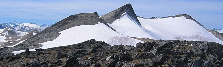
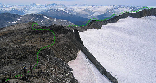
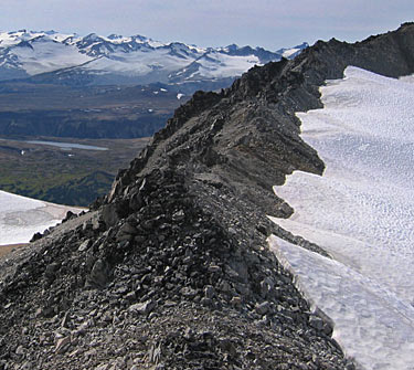
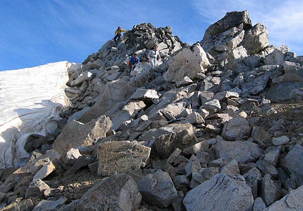
| Above: Here's yet another angle looking directly south. That mountain is Sorcerer at about 2601 meters. Day 5 would see us almost gaining its sub-peak to the right of the large snowfield, then continuing through the col at center and taking a mountaineering route along the rough ridge tops far out of view to the right. And for you who are into trivial detail, yes, now the fly is back on the tent (nice and dry) as we get ready to leave for the day. | ||||||||||||||||||||||||||||||||||||||||||||||||||
 |
||||||||||||||||||||||||||||||||||||||||||||||||||
 |
||||||||||||||||||||||||||||||||||||||||||||||||||
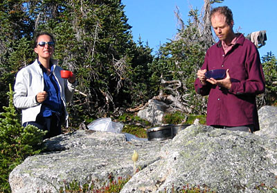
| Left: Sarah, in "Must - Have - Tea!!" mode. And Ashley in food-mode, but that's nothing new for either, actually!
Right: Reimar giving a good little stretch and twist, probably giving us a song as well! |
||||||||||||||||||||||||||||||||||||||||||||||||||
 |
||||||||||||||||||||||||||||||||||||||||||||||||||
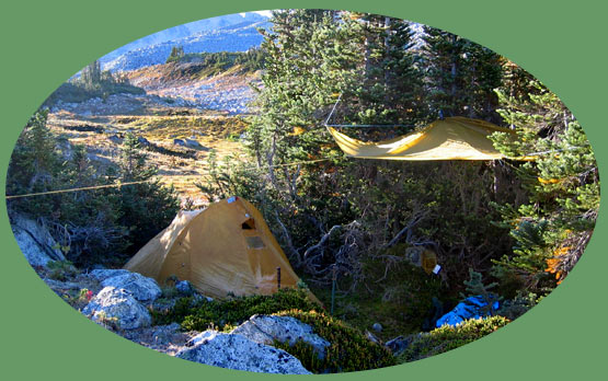
| Left: Special request from Ashley here, to include a shot of his and Sarah's cozy (can u say romantic??) little hide-a-way. | ||||||||||||||||||||||||||||||||||||||||||||||||||
 |
||||||||||||||||||||||||||||||||||||||||||||||||||
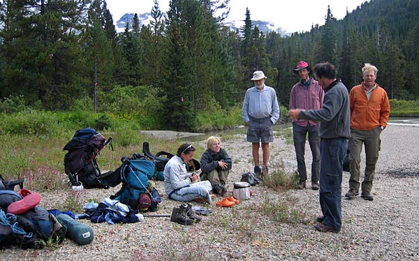
| Above: One last camp shot... Me at left, Ashley & Nick, Reimar at left. This was a pretty typical scene in the mornings - sitting around, talking, making food, etc. Got to have a bit of down-time between all that legwork! | ||||||||||||||||||||||||||||||||||||||||||||||||||
| And They're Off! The day begins... | ||||||||||||||||||||||||||||||||||||||||||||||||||
 |
||||||||||||||||||||||||||||||||||||||||||||||||||
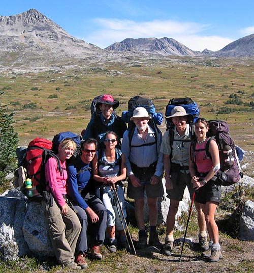
| L-R: Sarah, Ashely, Stephanie, Reimar, Andre, Nick | ||||||||||||||||||||||||||||||||||||||||||||||||||
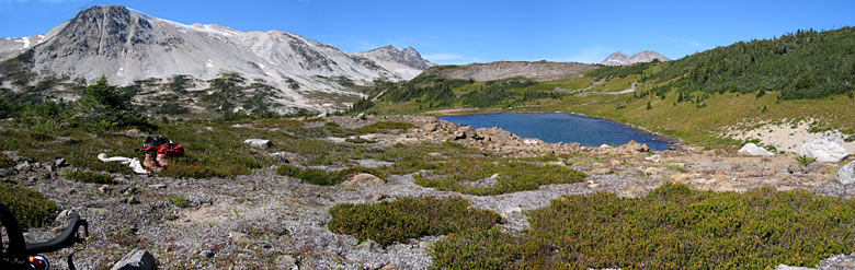
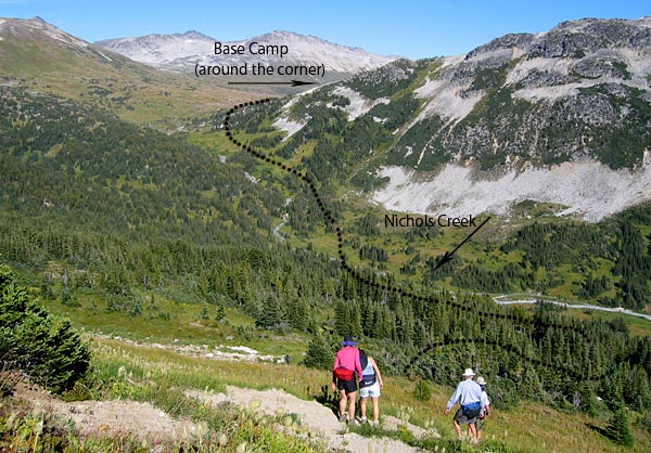
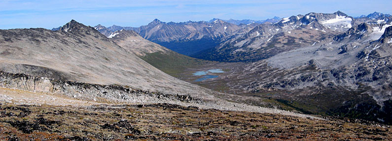
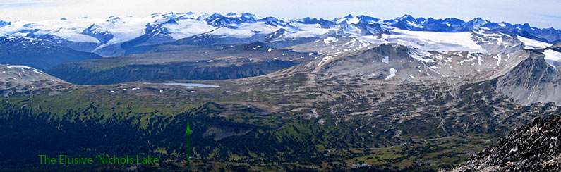
| Our plan was to hike to the large lake located at 471548E, 5641329N which we were referring to as "Nichols Lake". We'd seen this lake from the peak on a day hike in 2005 and were inspired by the size and remoteness of this lake, also that it seemed to just be nestled in amogst these vast plains and glaciers. Quite a unique setting.
We set out via the upper route marked in orange at left (click map for large version) and went north a bit to maintain elevation and cross Nichols Creek in an easier spot. |
 |
|||||||||||||||||||||||||||||||||||||||||||||||||
 |
||||||||||||||||||||||||||||||||||||||||||||||||||
| Click on map for large version | ||||||||||||||||||||||||||||||||||||||||||||||||||
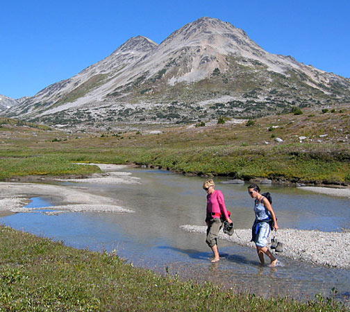
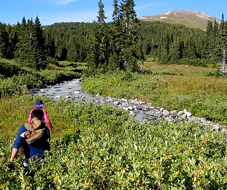
| En route we came across many of the little tarns that Andre, Nick & I had hiked by the day before to / from Griswold. One of the lakes bore a distinct resemblance in shape to Texas, our two Texans (though native Canadians, I should add) pointed out. It got marked in my GPS as "Texas Lake" for potential future reference.
Left: An easy crossing over the upper Nichols Creek |
||||||||||||||||||||||||||||||||||||||||||||||||||
 |
||||||||||||||||||||||||||||||||||||||||||||||||||
|
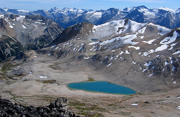
When we got to a shelf overlooking the lake where we then went for lunch it became clear that Nichols Lake was still separated from us by a much larger chasm than originally anticipated. The crystal blue waters of "Lunch Lake" were too much to resist - we made a beeline down the boulder slope to settle in for an hour or two of lakeside-leisure. |
||||||||||||||||||||||||||||||||||||||||||||||||||
 |
||||||||||||||||||||||||||||||||||||||||||||||||||
| Descending to "Lunch Lake"(Above L-R: Nick, Remiar, Stephanie, Andre, Sarah, Ashley, Below; Trudel) | ||||||||||||||||||||||||||||||||||||||||||||||||||
 |
||||||||||||||||||||||||||||||||||||||||||||||||||
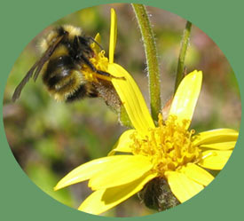
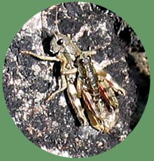
| I took this macro photo near the lake... | ||||||||||||||||||||||||||||||||||||||||||||||||||
 |
||||||||||||||||||||||||||||||||||||||||||||||||||
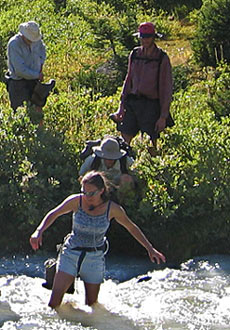
| I guarantee you 100% what was going through my head in the photo above - just have a look at the photo below!! I just coulnd't get in there fast enough! | ||||||||||||||||||||||||||||||||||||||||||||||||||
 |
||||||||||||||||||||||||||||||||||||||||||||||||||
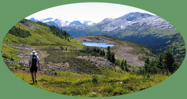
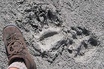
| We'd hiked in from the bluff above the lake (center; above photo and right of center below). "Nichols Lake" lies to the left of the boots (below) by about 2-3 km's. | ||||||||||||||||||||||||||||||||||||||||||||||||||
 |
||||||||||||||||||||||||||||||||||||||||||||||||||
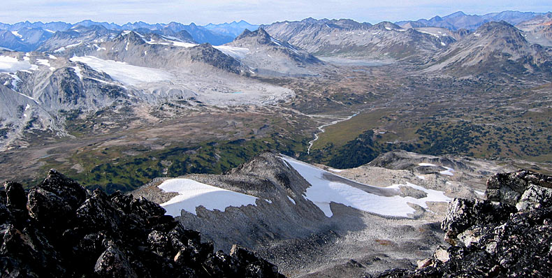
| About 3:00 we figured it was a good time to make our way back to camp. We were faced with retracing our rather long route in, or returning by descending steeply to Nichols Creek, hiking up the creek, crossing it a couple times and ascending to the Slim Pass. Feeling adventurous we opted for the latter. | ||||||||||||||||||||||||||||||||||||||||||||||||||
 |
||||||||||||||||||||||||||||||||||||||||||||||||||
| Starting the descent (L-R: Stephanie, Sarah, Reimar, Andre). As you can see, its a bit of a ways down, and up again. | ||||||||||||||||||||||||||||||||||||||||||||||||||
 |
||||||||||||||||||||||||||||||||||||||||||||||||||
 |
||||||||||||||||||||||||||||||||||||||||||||||||||
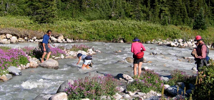
| Once down in the Nichols drainage, we waded through tall bushy willow and scraggly stands of trees. There were 3 crossings in all of various branches of the creek.
Left: Nick & Stephanie approach the first minor crossing Right: Sarah at crossing # 2 or 3 with Andre, Ashley & Reimar waiting in line |
||||||||||||||||||||||||||||||||||||||||||||||||||
 |
||||||||||||||||||||||||||||||||||||||||||||||||||
| Sarah making another crossing with brother Nick ready to lend a hand and Stephanie and Ashley getting ready to cross | ||||||||||||||||||||||||||||||||||||||||||||||||||
 |
||||||||||||||||||||||||||||||||||||||||||||||||||
| Sarah, Stephanie, Reimar and Ashley (red hat only) coming down a steep embankment. I remember someone was eating Sesame Snaps here ... funny, the things you remember | ||||||||||||||||||||||||||||||||||||||||||||||||||
 |
||||||||||||||||||||||||||||||||||||||||||||||||||
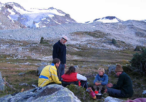
| Another adventure over for the day, we settle in at camp for a hot meal and some good RNR.
L-R: Ashley, Reimar, Sarah, Stephanie, Nick |
||||||||||||||||||||||||||||||||||||||||||||||||||
| GPS waypoints: | Lunch: 476932E, 5643110N | Peak: 475741E, 5642248N | ||||||||||||||||||||||||||||||||||||||||||||||||


| Help! I'm being swallowed by the tent!!
What a way to start off the day... Once I managed to get the thing off me I managed to join the others in breaking down camp and packing up. Time to head back to the rest of the world. It would take us most of the day to make it back down to our first camp in the woods next to Slim Creek. And the camp would have been pretty difficult to find, but thanks to the GPS we walked right to it. |
 |
|||||||||||||||||||||||||
 |
||||||||||||||||||||||||||
|
L-R: Stephanie, Nick, Sarah, Ashley, Reimar, Andre, Trudel As the famous saying goes, "Are Ve Ready To Go??!"
|
||||||||||||||||||||||||||
 |
||||||||||||||||||||||||||
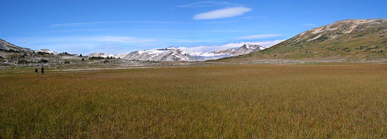
| On all the topo maps there is a large lake shown near the top of Slim Pass. We looked high and low for it and determined this (above; grass) was it! | ||||||||||||||||||||||||||
 |
||||||||||||||||||||||||||
| If Ashley's alien sculpture were still fully intact from the previous summer's hike, we would have been able to see it on the peak of that ridge above. | ||||||||||||||||||||||||||
 |
||||||||||||||||||||||||||
|
Nick, Ashley, Stephanie, Reimar
|
||||||||||||||||||||||||||
 |
||||||||||||||||||||||||||
|
Sarah, Nick, Ashley
|
||||||||||||||||||||||||||
 |
||||||||||||||||||||||||||
 |
||||||||||||||||||||||||||
| The freaks will stay together they're a tight old crew. | ||||||||||||||||||||||||||
| We look at them, and they look at you... (M.Knopfler) | ||||||||||||||||||||||||||
 |
||||||||||||||||||||||||||
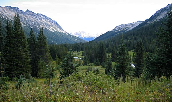
| Back to the timberline... | ||||||||||||||||||||||||||
| Uh-Oh!!
So we're all just hiking along through meadows dotted with small trees (roughly like the above photo). We're spread out in smaller groups of 2 or so; Stephanie and I are near the back deep in conversation when I notice a hole in the ground absolutely filled with buzzing insects. Strange, I thought, and bent down for a closer look. Bad idea. The immediate realization of unescapeable, imminent pain clouds my senses and I take off at a full speed run screaming, Stephanie in hot pursuit, Reimar close behind us and the others running along in bewilderment. Once we came to a stop we assessed the damage - I had several stings on my calves and Stephanie fortunately only had one. Reimar hollered for an onion - who packs onions hiking, and if so, who would have any left on the second-to-last day? Apparently Nick! The onion halves soothed the skin, and we were all on our merry way. |
||||||||||||||||||||||||||
 |
||||||||||||||||||||||||||
| About a half hour later we came to an abrubt stop as Stephanie threw off her pack and started wriggling with extreme discomfort. Her entire body, toes to scalp, was covered in massive red, puffy welts, layer upon layer. The poor girl looked like something out of a science fiction movie. Apparently she's allergic to wasp stings, but had not had a reaction in over a decade, including a couple weeks before when she'd been stung in Kelowna. Nick took her down to the creek for an icy bath while the rest of us scrounged through our packs for any suitable first aid. Between us we came up with an anti-hystemine, ibuprophen, a homeopathic anti-sting remedy, and various topical anti-sting treatments. If anything worked, it was more phsychological than anything.
We were all of course extremely concerned, and decided it would be best to stay put for an hour and have our lunch at the same time. After an hour, Nick took the remainder of most of her gear and we continued on. |
||||||||||||||||||||||||||
 |
||||||||||||||||||||||||||
| About 4:00 we found ourselves back at the flat open beach. We were considereing camping there for the night, and took off our packs to have a little break and assess the options. It was becoming cooler, and looked like it might rain; the forest camp from our first night might afford more shelter.
Sarah made tea, Stephanie suffered silently while always affirming with a big smile that she was fine, the boys raced "boats" in the creek and I took photos and tried to lie down, using my pack as a backrest. |
||||||||||||||||||||||||||
 |
||||||||||||||||||||||||||
| The forest camp was easily found and camp quickly set up. Stephanie and I each retreated to our tents to rest, while the others made a fire, strung up a tarp and began dinner preparations. I came out after about an hour, followed shortly by Stephanie. Her discomfort had subsided somewhat, but the leg that had been stung was swolled to nearly twice its normal size. | ||||||||||||||||||||||||||
| Rain. And not light-dry-country-rain but don't-you-miss-Vancouver-well-here-you-go rain. Hiking through rain, in the proper gear, is tolerable, setting up camp in rain is usually a relief, but packing up camp in rain is just miserable no matter how you look at it. Forget about any weight savings with all the food you ate the days and night before, forget about warm fingers, forget about keeping grit and needles out of your clothing and pack.
And for poor Stephanie, with her leg so swollen she couldn't even get her boot on, forget about dry feet or any sembelance of comfort at all. The photo at right doesn't do it justice, believe me, in reality that leg looked like a club next to her other one. She was forced to hike out in thin socks and her slip in 'Crocs'. And this is not some groomed trail we were travelling on either - in many places we were lucky to be following a flagged route through boggy marsh which oozed even through our heavy boots. We began hiking at about 9am, and shortly before reaching the trailhead the weather began to lift. By the time we reached the trailhead the sun was out and we happily peeled off layers of GoreTex, hats, etc. Now, thanks to the vehicle-that-shall-not-be-named, we had a 2 km walk back to the Jetta & Van. But it was nice out and our last few moments hiking together after a wonderful 6 days of adventure. |
 |
|||||||||||||||||||||||||
| top of page | ||||||||||||||||||||||||||