


 |
|||||||||||||||||||||||||||||||||||||||||||||
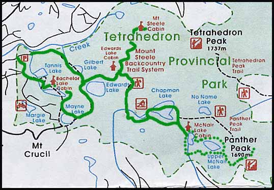
| Where: Tetrahedron Provincial Park is located on the Sunshine Coast north of Sechelt. The maps below show the area and the trails in greater detail. Tetrahedron Peak is the tallest peak on the Sunshine Coast and towers above the other high peaks in the park; Panther and Steele.
The Cabins: There are four backcountry cabins in the park, built and maintained by a local ski club. They are available on a first-come-first-serve basis and the fees are by donation. Three of the cabins are located near lakes: Edwards Lake, McNair Lake and Bachelor Lake, while the fourth cabin is situated high on Mt. Steele, just below the peak. They are all spacious and comfortable, with a loft for sleeping. They are rustic, wood stove only and the sink empties into a bucket which you have to empty. No electricity, no running water. The Bachelor Lake cabin is quite run-down, probably mainly because it is the closest to access. |
|||||||||||||||||||||||||||||||||||||||||||||
| Area Map: Two maps of slightly different scale off the BC Parks site which I spliced together so you can see the relation to Vancouver. | |||||||||||||||||||||||||||||||||||||||||||||
 |
|||||||||||||||||||||||||||||||||||||||||||||
| Trail Map: The green line is the route we took. From the Parking lot we hiked in via Gilbert Lake past Edwards Lake, over Chapman Lake (via dinghy) to the cabin above McNair Lake. The dotted route is our day hike up Panther Peak. On the return we hiked back to Edwards Lake via the shores along Chapman and up Mt. Steele to the Cabin. We passed by Mayne and Bachelor Lakes on the return to take in all the cabins and lakes. | |||||||||||||||||||||||||||||||||||||||||||||
 |
|||||||||||||||||||||||||||||||||||||||||||||
| Day 1: Trail Head to McNair Lake
We awoke at 6am to a warm, sunny morning, a four-day adventure on the Sunshine Coast lying ahead of us. We caught the 7:20 ferry and arrived at Langdale just after 8am. There was a 10 minute delay to the crossing as crews performed a mandatory safety drill of launching a rescue boat. A large, grey zodiac was lowered into the water carrying two survival-suit clad men who, once on the water, promptly raced off out of site while the ferry continued on to Langdale, only a few minutes away. |
|||||||||||||||||||||||||||||||||||||||||||||
| Travelling north to Sechelt in Ian's 4-Runner (borrowed for the weekend as we were "between" 4x4 vehicles ourselves), we took the road past Porpoise Bay Prov. Pk., then branched off on the rough logging road that took us up to the Tetrahedron trail head. |  |
||||||||||||||||||||||||||||||||||||||||||||
| Andre gives those hamstrings a final stretch before slinging on his monster pack (at left) | |||||||||||||||||||||||||||||||||||||||||||||
| After leaving the car, we hiked up an old logging road, following through one clear cut after another. We truly began to wonder if there would be any forest left and did began to question the area, despite the guide book having mentioned: "...you will begin to believe you have been brought there under false pretenses". | |||||||||||||||||||||||||||||||||||||||||||||
 |
|||||||||||||||||||||||||||||||||||||||||||||
 |
|||||||||||||||||||||||||||||||||||||||||||||
| The forest now beginning to resemble old growth, Andre snapped this shot of me just as I was swatting at a cloud of bugs trying to feast off my eyeballs! Um, is that pack big enough for 4 days?? | |||||||||||||||||||||||||||||||||||||||||||||
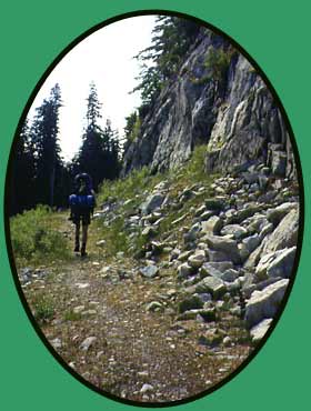
| Andre makes his way along a pretty little stretch of trail below some cliffs | |||||||||||||||||||||||||||||||||||||||||||||
| Soon enough we spied a small footpath branching off the road, along it high poles stuck in the ground marking the route for winter travel. The path became smaller and smaller, eventually an even smaller footpath branching off and leading down to Edwards Lake. Though sweating like mad in the humid early afternoon heat, we didn't go in for a swim and only dropped our excessively heavy packs for a ten minute break. | |||||||||||||||||||||||||||||||||||||||||||||
|
All About Bugs Normally bugs don't bother me so much. I kind of survive by ignoring them and letting them feast off Andre, whom they always prefer to me. I very rarely have to apply bug spay. Here, however, I made an exception. The sheer number of mosquitoes, black flies and worst of all, those eyeball-sucking-inner-ear-crawling gnats was enough to drive most people back to the car, down the hill and to the beach. We, however, lathered ourselves in special natural lotions available only through certain retails in the States and for which we made a special trip to Bellingham. These lotions, unlike any natural stuff available here, actually work very well. I've used 90% DEET before and not had it work, and frankly I don't want to risk having it enter one of my usual bloody bush-wounds and crumpling up in seizures in the middle of the woods. |
|||||||||||||||||||||||||||||||||||||||||||||
|
The Edwards Lake Cabin So we thought, here we are at the lake, the cabin should just be around the corner. In your dreams. It was a good 20 minute hike further on, all gradually uphill, and not even close to the lake. Most often this would not phase us one bit, but it was at least 32 degrees, humid, and we had these psychotically heavy packs. We had a two-person dinghy, two extra-heavy marine-grade folding paddles (we broke the lightweight ones on an earlier trip), a 10-pound tent (we didn't know the cabins would be so luxurious, some backcountry cabins can be pretty nasty), a 2-pound telescope plus its tripod, and some crazy heavy food for the first night. Lets just put it this way, I carried about 8 pounds less on the 10-day trek later on that summer (South Chilcotins and Big Creek Park)! We were very surprised to find such a quaint cabin. It was nice and cool inside, and the upstairs loft even had a little balcony accessed through a small window over the front porch. We made ourselves comfortable at the picnic table in the shade of the porch and settled in for a long-overdue lunch. |
|||||||||||||||||||||||||||||||||||||||||||||
 |
|||||||||||||||||||||||||||||||||||||||||||||
| Sitting on the upper balcony of the Edwards Lake cabin. | |||||||||||||||||||||||||||||||||||||||||||||
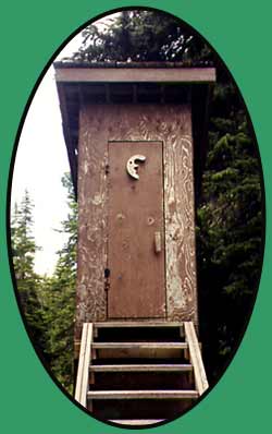
| ......comes complete with a first class outhouse!!! | |||||||||||||||||||||||||||||||||||||||||||||
 |
|||||||||||||||||||||||||||||||||||||||||||||
| After lunch we hiked downhill for a long time through dense fields of blueberry bushes and as we got lower in elevation small ponds began to pop up all around us. We hauled-ass through the boggy areas of muddy ground and skunk cabbage, barely managing to keep one step ahead of the insects.
After crossing Chapman Creek on a well constructed bridge, the trail wound through the forest, eventually opening up to a large meadow and boggy area just below the outflow. The creek itself became as wide and calm as a small lake (below). |
|||||||||||||||||||||||||||||||||||||||||||||
 |
|||||||||||||||||||||||||||||||||||||||||||||
| I managed to get myself over this log, but Andre opted for a little snooze on his way over! Nice backrest! | |||||||||||||||||||||||||||||||||||||||||||||
 |
|||||||||||||||||||||||||||||||||||||||||||||
| The boggy area and outflow just below Chapman lake | |||||||||||||||||||||||||||||||||||||||||||||
| From the meadow, the trail back into the forest was a bit tricky to find, but of course Andre spotted it quickly enough. The ground sucked at our boots and soon we came to another fork. The right continued around the lake, while the left, the one we took, led to a narrow shoreline on the lake. | |||||||||||||||||||||||||||||||||||||||||||||
|
We weren't able to see much of the lake because it makes a corner, and were a little disappointed at the sight as we'd originally planned to camp somewhere along Chapman Lake (thus the dinghy). Making the best of it, Andre inflated the boat while I purified about 5 liters of water from the lake for drinking. Once inflated, we took off our boots, heaved the packs in and settled our tired bodies into the boat. More like on top of the packs in the boat! Andre took the front, while I sat up high on my pack on the back and we slowly began to paddle to the middle of the lake. |
 |
||||||||||||||||||||||||||||||||||||||||||||
 |
|||||||||||||||||||||||||||||||||||||||||||||
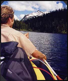
| Paddling across Chapman Lake, Panther Peak looming in the distance. Little did we suspect we'd be sitting on its peak in less than 24 hours! | |||||||||||||||||||||||||||||||||||||||||||||
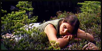
| After the paddle I crashed on the prickly heather for a snooze while Andre deflated and packed the boat back into his pack | |||||||||||||||||||||||||||||||||||||||||||||
| Paddling the lake gave us a good chance to survey the surrounding area and we quickly realized, though nice enough, it was not where we would want to base ourselves for a couple days. Now late afternoon, we decided to push on to the McNair cabin and see what that location had to offer. Once on shore, Andre deflated the boat and packed it back into his pack. We made our way up through sub-aline meadows, climbing gradually when all of a sudden the cutest little cabin we'd ever seen poked over the trees. Crossing our fingers to have the place to ourselves, we made our way up the slope through the trees and berry bushes up to the front steps of the cabin. |
|||||||||||||||||||||||||||||||||||||||||||||
 |
|||||||||||||||||||||||||||||||||||||||||||||
| Approaching the McNair cabin from Chapman lake. Can you spot the cabin peeking above the trees at the upper left? | |||||||||||||||||||||||||||||||||||||||||||||
| The McNair Lake Cabin
Finding the cabin empty and very clean, we set down our packs, changed out of our boots into sandals and headed down the slope on the opposite side to have a look at McNair Lake. The shores themselves were about a five minute walk away, and we tossed around the idea of pitching our tent in the wide meadow along the lake. The comforts of the cabin beckoned, however, so we just opted for a quick wash in the lake, then settled in for a relaxing evening. |
 |
||||||||||||||||||||||||||||||||||||||||||||
 |
|||||||||||||||||||||||||||||||||||||||||||||
 |
|||||||||||||||||||||||||||||||||||||||||||||
| The sun setting behind Mt. Steele, Andre standing to the right of the cabin. | |||||||||||||||||||||||||||||||||||||||||||||
 |
|||||||||||||||||||||||||||||||||||||||||||||
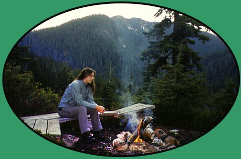
| Enjoying the campfire. Mt. Steele is the peak at centre. | |||||||||||||||||||||||||||||||||||||||||||||